M25 Junction 20: Kings Langley (A41, A4251)
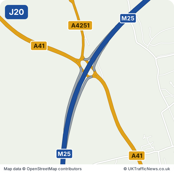
Junction 20 at Kings Langley links the M25 to the A41 for Hemel Hempstead, Berkhamsted and Aylesbury, and the A4251 for Kings Langley, about a mile north. Abbots Langley and Leavesden are close by. The Paper Mill Museum at Apsley is about three miles north.
Hemel Hempstead and Kings Langley residents, workers at the Leavesden studios and business parks, and families heading out along the A41 use Junction 20.
Check this junction now: live M25 speed flow map · latest M25 traffic news · M25 serious incidents · M25 accidents
M25 Junction 20 Now: Accidents, Incidents and Roadworks
Live traffic news at M25 Junction 20
This is the news for Junction 20 only, not the whole M25. For the rest of the motorway see all the latest M25 traffic news, the overhead signs and the speed limits in force now.
Updated 12:07 (12:07pm) Wed 11 Nov 2026
Live Traffic Speeds at M25 Junction 20
The speed strip below shows the M25 around this junction, both directions, from National Highways’ live data, checked every five minutes.
Untick all three to see just the speeds. We show the important overhead signs and the mandatory speed limits (red ring); see every overhead sign.
Go to our live M25 traffic speed flow map ›
NOTE: The speed flow, overhead sign messages or other information shown on our live traffic speed flow map is updated every few minutes. We cross check the data and aim to provide warnings if there could be a delay or an inaccurate speed reading. There can be occasions, beyond our control, and despite our best efforts where the speed flow could be inaccurate. We cannot therefore guarantee the speed you can expect on any stretch of the motorway is always accurately shown. However we hope you will find our live traffic speed flow map a useful tool in trying to plan your journey. Safe driving.
Refresh the page to see the latest speeds.
All the latest M25 traffic news →Live M25 traffic speed flow map →
M25 J20 in Our Records
More than half of the incidents we recorded at J20 were collisions (3 of 5). Clockwise, the slowest daytime hour is 17:00, about 7 mph below the typical speed. Anticlockwise, traffic usually keeps close to its typical speed through the day; the slowest hour is 07:00.
Average speed by hour of day at J20
Clockwise
Anticlockwise
Incidents per week at J20
The latest 5 here
- Thu 5 Nov, 01:37 (1:37am) Collision ✓Reported by National Highways
M25 anti-clockwise between junctions J20 and J18
✓ Cleared after about 96 minutes (1.6 hours) - Wed 4 Nov, 06:38 (6:38am) Broken Down Vehicle ✓Reported by National Highways
M25 anti-clockwise between junctions J20 and J19
✓ Cleared after about 37 minutes - Tue 3 Nov, 06:05 (6:05am) Collision ✓Reported by National Highways
M25 anti-clockwise between junctions J20 and J18
✓ Cleared after about 62 minutes (1.03 hours) - Sat 24 Oct, 10:19 (10:19am) Collision ✓Reported by National Highways
M25 clockwise exit slip at junction J20
✓ Cleared after about 80 minutes (1.33 hours) - Thu 15 Oct, 17:47 (5:47pm) Broken Down Vehicle ✓Reported by National Highways
M25 anti-clockwise between junctions J21 and J20
✓ Cleared after about 14 minutes
Built from our own records of National Highways’ live data for the M25 either side of J20: speeds from 28 days of five-minute readings, incidents from the last 30 days (we started recording incidents on 09/10/2026). Each incident is counted once. Updated every five minutes.
- Junction M25 J20, Kings Langley
- Roads at this junction A41, A4251
- Nearest town Kings Langley, 1.1 miles north
- Junction before J19, Chandlers Cross, about 1.6 miles in a straight line
- Junction after J21, Chiswell, about 2.8 miles in a straight line
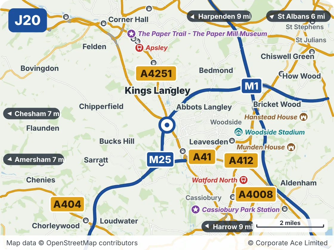
Around M25 Junction 20: Kings Langley: Towns and Places on the Map
| Place | What it is | From the junction |
|---|---|---|
| Woodside Stadium | Venue | About 2 miles east |
| Apsley | Railway station | About 2.5 miles north |
| Cassiobury Park Station | Attraction | About 2.5 miles south |
| Watford North | Railway station | About 3 miles south-east |
| The Paper Trail - The Paper Mill Museum | Attraction | About 3 miles north |
| Munden House | Historic house or castle | About 4 miles east |
| Hanstead House | Historic house or castle | About 4 miles east |